- Remote dry savannah landscape offering panoramic views
- Interesting remnants of mining and railway history
- Small mining museum at Irvinebank
- Numerous campsites on Boonmoo Station
Nearby Attractions
- Remote trail with ‘high independence’ factor
- Safe cycling with very limited traffic
- Part of an increasingly popular multi-day savannah cycle journey
- Opportunity to extend the adventure on the weekly Savannahlander train at Boonmoo siding – see link here
Last updated: 21 November 2022
This is more of an adventure/historic ride than a formal rail trail, with a mixture of quiet, Council-maintained roads and harder station tracks. The ride can also be linked into the Mt Garnet to Lappa Rail Trail ride to create a multi-day savannah adventure.
Section Guides
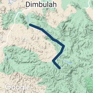
Starting at the small settlement of Irvinebank (free camping, toilets and shower), ride east for about 6.5 km on the Irvinebank to Petford road. There are obvious remnants of the original rail alignment on the southern side of the cutting near Gibbs Creek leading out of Irvinebank.
Turn north at Hales Siding Road and ride north for 5.75 km to the intersection of Stannary Hills and Hales Siding Road. Again, the alignment is close to the road with historic Weinert’s siding signposted on the eastern side of this road. It is a further 5.65 km of easy riding to the marked Stannary Hills historic site.
NOTE: Only ride the trail described below with prior permission from the Gunderson family, owners of Boonmoo Station; contact (07) 4094 4129. Riding without permission will constitute trespass and legal action will be taken. Leave access gates as found and do not disturb cattle and wildlife. The Gundersons offer affordable outback camping at a number of attractive sites along Eureka Creek. See link here.
From the Stannary Hill historic site about 2 km of the original tramway is accessible on bikes. Ride downhill, cross Eureka Creek and enjoy the short ride to historic mining features and impressive cuttings. The balance of the original tramline has been blocked by landslides but is accessible on foot for some distance.
Backtrack up the hill for 2 km and locate the station track on the right hand side just before and opposite Stannary Hills Cemetery. This is the cue to head west.
Travel downhill on this rough station road with Bock Creek on your right. After 5 km Bock Creek merges with the more substantial Eureka Creek and you will ride on and see remnants of the original alignment as well as old bridges, ore bins and so on. Riding downstream next to Eureka Creek you will come to Boonmoo Station homestead about 20.5 km from the turnoff on Stannary Hills Road. Boonmoo siding is a further 500 m from the homestead and is on the Cairns-Forsayth line, traversed weekly from March to September by the Savannahlander. See link here.
It is a further 15 km by road from Boonmoo siding to the small township of Dimbulah and civilisation.
WARNING!
Sections of these trails – particularly between Stannary Hills Cemetery and Boonmoo Station homestead –cross through a remote pastoral area with no services and limited mobile reception. Self-supported cyclists and/or support vehicles should carry plenty of water, a 1:50,000 Irvinebank topographical map, comprehensive first aid, food/fuel and viable communication systems. Eureka Creek may be impassable in wet conditions; seek local advice at Irvinebank before embarking on this ride.
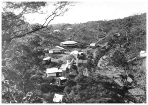
Stannary Hills railway yards circa early 1900's
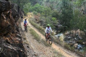
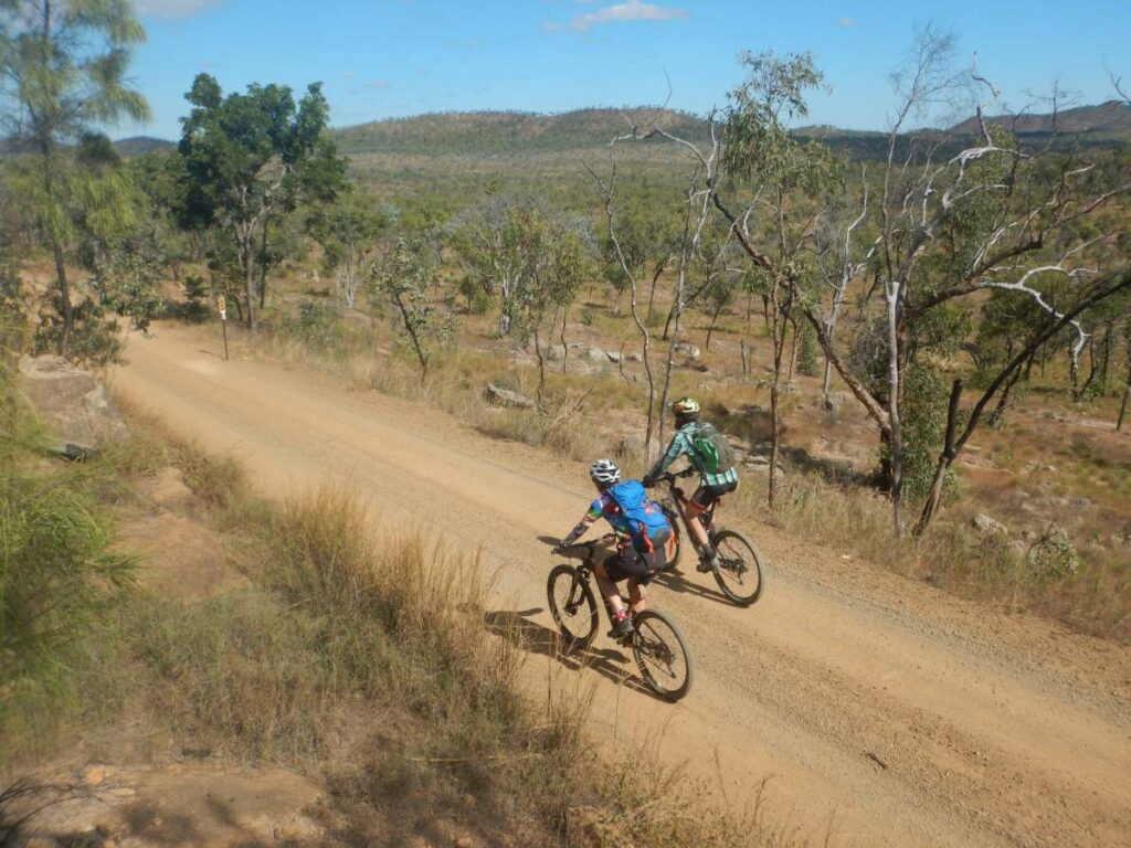
Cyclists riding the former rail line above Eureka Creek
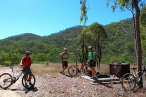
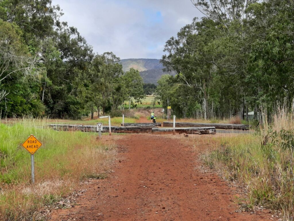
Cyclists next to Stannary Hills memorial site
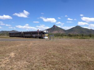
Savannahlander on Forsyth to Cairns line with Boonmoo Hill in background
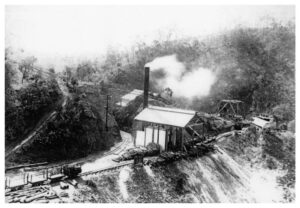
Stannary Hills circa early 1900's
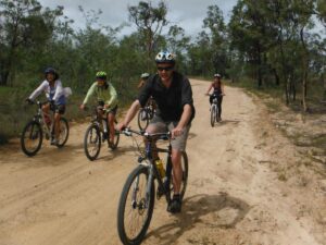
Cyclists on Hales Siding to Stannary Hills section of the rail trail
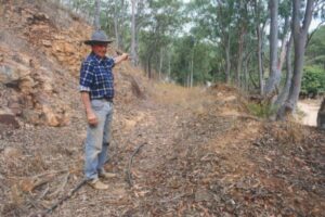
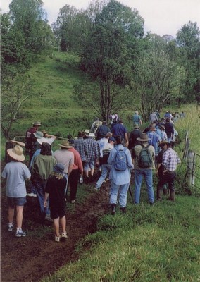
A local points to where the old 2 foot gauge railway once lead.
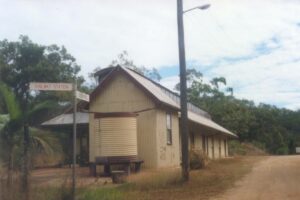
An old station building.
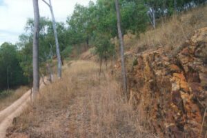
Current condition of the old railway formation.
Do you know of a bike hire or transportation service on this rail trail that should appear here? If so, let us know at admin@railtrails.org.au.
Information and Links
Contact Rail Trails Australia
To contact us about this rail trail, email qld@railtrails.org.au
Background Information
Traditional owners
We acknowledge the Mbabaram people, the traditional custodians of the land and waterways on which the rail trail is built.
Development and future of the rail trail
While the Stannary Hills to Boonmoo and Stannary Hills to Irvinebank Tramway formations are heritage listed, it is unlikely they will be reinstated for formal trail use given the remoteness, poor general condition and important current use for station access in this region.
Rail line history
In 1884, tin deposits were found at Eureka Creek, and a mining town named Eureka was formed by 1888. It was later named Stannary Hills (stannum is Latin for tin).
In 1902 a two feet gauge tramway was built from Stannary Hills to the Cairns-Chillagoe railway, following the Eureka Creek valley and joining the railway at Boonmoo. The tramway lowered the costs of transporting tin out of Stannary Hills (the mines had not been worked for about eight years), and the ore was processed at a nearby battery at Rocky Bluff on the Walsh River.
Five years later the tramway was extended south to Irvinebank tin mines, making Stannary Hills and Irvinebank a major base-metal region.
The post office directory for 1911 recorded eight hotels at Stannary Hills, along with stores, a hospital, two butchers, two bakers and a teacher. By 1920 there were four hotels, and the Jack and Newell’s branch store had closed. Ten years later one hotel was left. The tramway was closed in 1936 and the rails were taken for scrap during World War II. Some of the timber bridge supports remain. In 1948 the last hotel closed and in 1955 the post office closed. Today there are near no signs that this was once a thriving community.
Reference – Queensland Places
Nearby Trails
Mt Garnet to Lappa Junction
Start point is at Mount Garnet, approximately 190 km south west of Cairns
55 km


Atherton Tablelands Rail Trail
Atherton, 88km south west of Cairns, 1730km from Brisbane
20 km


Irwin Track Rail Trail
Millaa Millaa, Atherton Tablelands, 1350km from Brisbane

Nearby Trails
Mt Garnet to Lappa Junction
Start point is at Mount Garnet, approximately 190 km south west of Cairns
55 km
Atherton Tablelands Rail Trail
Atherton, 88km south west of Cairns, 1730km from Brisbane
20 km
Irwin Track Rail Trail
Millaa Millaa, Atherton Tablelands, 1350km from Brisbane
One review of “Irvinebank to Boonmoo Rail Trail”
Ride this trail with prior permission from the owners of Boonmoo Station, the Gundersons- friendly and helpful people who gave us advice and a map to follow. We rode this trail for a few hours enroute to Irvinebank on mtbs towing Bob trailers, as part of a much longer tour which included the better known Lappa Rail trail a couple of days later. Some interesting old cuttings and relics, also scenery along Boonmoo Creek. For day trippers, organise drop off and pickup at the Dimbulah and Irvinebank ends. Contact owners beforehand.